The Complete Paddler
Chrismar Maps: Temagami 5 - Chiniguchi Area
Chrismar Maps: Temagami 5 - Chiniguchi Area
Couldn't load pickup availability
Our#: AM0869, ISBN: 0-929140-869, Scale: 1:60,000. Waterproof.
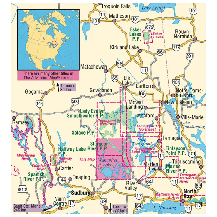
This map shows the southwestern side of classic Temagami, an area of relatively easy access by car to a number of points along the southern edge, plenty of remote paddling, connections to other parts of Temagami or the ideal area for a fly-in trip. In addition to a selection of paddling routes through large and small lakes, there are several great river routes, one of the higher peaks in Ontario, and the fabulous Wolf Lake Forest Reserve, renowned for its white quartz cliffs, and even a secret lagoon.
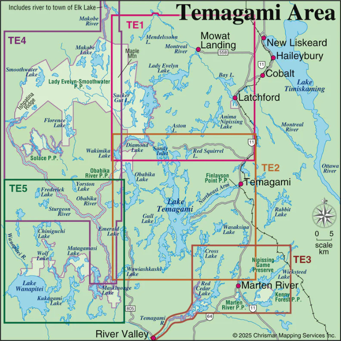
Ours is a large-scale map showing all or parts of 4 Provincial Parks - Chiniguchi Provincial Waterway Park, Wanapitei Provincial Park, Sturgeon River Provincial Waterway Park and Obabika River Provincial Waterway Park, as well as the Conservation and Forest Reserves that border and help protect them. And beyond these reserves there is plenty of Crown land to explore. Altogether, these Parks and their companion Conservation Reserves provide a grand network of protected wilderness and canoe routes that can stimulate your senses and give your body a work-out for weeks.